Showing posts with label flash floods. Show all posts

Thursday, August 06, 2009

Assam Lingzey flash floods spells devastation


Assam Lingzey (East Sikkim): Rainfall of 4th August night around 9.30 and sudden spurt of high rise of water in the stream Takcham Chu caused landslide resulting in extensive destruction in various parts of Assam Lingzey under Namcheybung Constituency. Villages like Pastenga, Khola Gaon, Kabra Botey, Goucharan suffered huge damage. A 80 ft high bridge that links Naitam and Assam Lingzey is heavily damaged by gushing water.
From 14th Mile to Setipool near Ranipool, ginger fields, cardamom field, orange field are all damaged. Around 200 families of Pastenga power colony are under serious threat of landslide as large cracks are seen around their quarters. Being fearful, they have started removing valuables from their houses and some of them have already left the area. The road that links Pastenga with Ranipool Bazaar has been breached by landslide and people have lost connection with Ranipool.
As the mishap happened at night, many people could not save their cattle. One milching cow along with the shed of Krishna Bdr. Tamang of Nimthang Saramsa, four pigs of Anand Rai of the same area are lost.
Area MLA Mr. Beg Bahadur Rai, SDM East Dr. AB Karki, Chief Engineer Roads and Bridges along with departmental officers and panchayats visited the devastated area Wednesday. The MLA promised to the victims to provide every possible help. After assessment victims will be compensated within a week, he said. For construction of a protection wall, he has asked the DC to take early initiative.
Local people raised their voice to implement Brahmaputra Yozna, a project to construct bridge and dam over the three main rivers of the area as a solution. MLA Mr. Rai also agreed that implementation of said project will solve problems of locals.

Namcheypong MLA visits flood affected areas of Mile 14 and Setipul


GANGTOK, August 5: MLA Namcheypong Beg Bahadur Rai today visited the flood affected areas of Mile 14 and Setipul in East Sikkim.
The torrential rain that occurred last night has badly damaged the crop and the cattle at Assam Lingzey, Kabra Botey and Goucharan.
A party communiqué adds that the bridge which was the lifeline for the people of the area has also been washed away by the flood. Besides, the road leading from Mile 14 to Gangtok has been washed away disrupting the entire vehicular movement.
During the visit, the MLA interacted with the local villagers and assured that the affected family will be fully compensated as per the government’s rule, the communiqué said

Monday, September 17, 2007

BRO reopens North Sikkim road link


Gangtok, Sept. 16: The Border Roads Organisation (BRO) has set up a new Bailey bridge over the Teesta in Zema, North Sikkim, three weeks after a pair of similar bridges at the spot were washed away in a flash flood.
The 120ft-long bridge was opened to traffic on Friday.
“The 86 RCC, a unit of the Border Roads Task Force, prepared the site and constructed the abutment. Once that was done, the bridge was set up in less than 24 hours,” a BRO official said.
The two Bailey bridges that connected Thangu, Gurudongmar and other alpine areas of North Sikkim with the rest of the state were washed away by a flash flood on August 25. The flood had also damaged 800 metres of the road.
Around 200 Lachenpas, who practice shifting cultivation, and large number of army jawans posted in the border areas remained cut off for the intervening period.
Before the new bridge was set up, army engineers had put in place a cable way to facilitate supply of essential stores and ration to the troops.

Tuesday, September 04, 2007

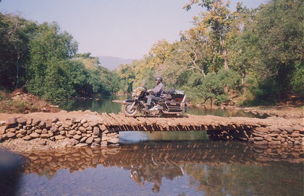
Zema Chu in North Sikkim gets log bridge


Mangan,Sep 03:Four days of hard toil,grit,and personal contribution from the public and the youth of Lachen and surrounding areas have culminated in a temporary log bridge being constructed over the ZemaChu near Lachen,North Sikkim after the flash flood of 25 august washed away the exiting bailey bridge over the stream.

The initiative was taken up and delivered solely by the public here ,reconnecting the cut off areas beyond like Thangu and Gurudongmar to establish the supply chain of ration and essential items.
The construction of the log bridge began on the 27 August and was successfully completed on 30 th August .On the day it was completed,a team of officials including DC north T.N.Kazi,Senior SP- ST Bhutia,WO -PW Lepcha accompanied by Lachen Pipon- Cho Rabzor and the public members visited the affected site.
Lauding the efforts of the area people,the DC informed that another,more reliable bridge would be constructed over the river soon by the Land Revenue and Disaster Risk Management department of state government.
Meeting was also held at Lachen Dzumsa wherein it was discussed that UN DP Tourism project would be implemented for Lachen.The district administration further directed the Food Supply Inspector PaldenZangpo to ensure that the supply of essentials is adequate in and above Zema.
meanwhile, the Chungthang -Lachen Roadway has been suffering road blocks owing to number of landslides along it, and the meeting resolved to urge immediate attention of the BRO and concerned authorities to restore the affected spots.

Monday, August 27, 2007

SIBLAC SEE SIGNS OF GUARDIAN DEITIES'S ANGER


Nature's Fury Unleashed On North Sikkim


Gangtok , Aug27 :A press release from SIBLAC warns of dangers God's fury in context of recent flash flood in Lachen Chu just on the occasion of Pang Lhabsol as just another sign of nature's anger to kind of activities pursued by state government in North Sikkim with hydel project policy as the religious and sentiments on environment has been totally side tracked in the name of development.
It is also believed that the flash floods could have been caused due to the burst of Zemu glacier, which is an important glacier of Sikkim. The water level in Teesta river was risen to 40 feet's after floods on Saturday and now it has gone down by 30 feet's .There has been loss of lives as per animals is concerned but no loss of human lives is reported after the incidence.
Locals believe that the entire security of North Sikkim is being damaged by the up coming power projects. Meanwhile, the entire North Sikkim highway has been paralyzed and the road between Lachen and Guru Dongmar, Thangu area has been blocked. It has also disrupted communication between the Army and the civilians who live in the border areas.
This,a SIBLAC press release issued by its convenor Tseten Tashi Bhutia contends,' is apparently the symbol that indicates the wrath of the guardian deities subsequent upon to a different pollutant activities taking place across Sikkim and especially different power projects in Dzongu.

Environment abuse risks nature's revenge and the Dzongu flash floods incident following by LachenChu event should be seen also in light of religious sentiments and importance attached by local communities especially lepchas of Dzongu to Teesta river.

Press release informs that Government should take these strange incidence as warning of future perils that might be caused due to abuse of nature and not respecting historical religious significance therefore it request state government to come forward to on going hunger strike by ACT as it significantly relates to these very issues .
Meanwhile, in another separate communique,ACT echoed similar views and thoughts.

FLASH FLOODS IN THE HIMALAYAS


The Himalayas are one of the youngest mountain ranges on earth and represent a high energy environment very much prone to natural disasters. High relief, steep slopes, complex geological structures with active tectonic processes and continued seismic activities, and a climate characterised by great seasonality in rainfall, all combine to make natural disasters, especially water-induced hazards, common phenomena.
Flash floods are among the more devastating types of hazard as they occur rapidly with little lead time for warning, and transport tremendous amounts of water and debris at high velocity.
Flash floods affect thousands of people in the Himalayan region every year – their lives, homes, and livelihoods – along with expensive infrastructure.
According to a report by the International Centre for Integrated Mountain Development (ICIMOD), there are several different types of flash flood. The most common include intense rainfall floods (IRF); glacial lake outburst floods (GLOFs), landslide dam outburst floods (LDOF), and flash floods caused by rapid snowmelt (RSM) and ice. Failure of dams and other hydraulic structures can also lead to flash floods.
Intense rainfall is the most common cause of fl ash floods in the Himalayan region. These events may last from several minutes to several days. Such events may happen anywhere but are more common to mountain catchments. The main meteorological phenomenon causing intense rainfalls in the region are cloudbursts, stationarity of monsoon trough and monsoon depressions.
Landslide dam outburst
Debris from a landslide can temporarily block the flow of a river creating a reservoir in the upstream reach. The landslide dam can breach due to overtopping and cause huge floods known as landslide dam outburst floods (LDOF).
Glacial lake outburst
The glaciers in the Himalayas are mostly retreating, and as they retreat lakes can form from melt water held in by the now exposed terminal moraine acting as a dam. If the dam breaks the water can be released suddenly resulting in a glacial lake outburst flood.
Impact of climate change
Intense rainfall floods and landslide dam outburst floods are directly related to the hydrometeorological conditions and likely to be affected by climate change.
Climate models project an increase in monsoon precipitation in the region. Similarly the frequency and magnitude of extreme rainfall events are also anticipated to. GLOFs are related to glacial retreat which in turn is mainly due to climatic warming. It is therefore very likely that flash floods due to intense rainfall, landslide dam outbursts, and glacial lake outbursts will increase in the future.
Zemu Glacier Complex
Zemu Chhu originates as Poke Chhu from Zemu glacier, which is the largest glacier in Teesta basin and is about 25 km in length Zemu glacier lies on the eastern face of Khangchendzonga peak (8,598 m) and is joined by Simvo and Siniolchu glaciers on its right flank and Nepal Gap and Tent Peak glaciers on its left. It is joined by Hidden glacier on its left. Poke Chhu flows in W-E direction and receives drainange on its left bank from Thomphyak Chhu. Thereafter, it flows as Zemu Chhu to drain into Teesta River near Zema village. This glacier complex is comprised of 6 glaciers covering an area of 113 sq km.